«Missouri River • Great Plains • Rocky Mountains» | «Radio • Writs • Ride • Resources»
Rockface worn smooth by erosion and water along the trail.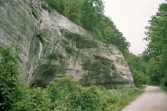
06/11/2001: Lexington, MO |
Damn These Shoulders! Which is something that I wouldn't have expected considering I began today's voyaging with a flat tire and then suffered another one ten miles from our late luncheon stop... A cheap hotel here in a town that appears to have been hoping for, but has never really seen, better days and the discovery that not only is whiskey inexpensive, but it's decent rye to boot. Tomorrow we do our best to make our way to leavenworth, hopefully circumnavigating kansas city's sprawl and the day's heat simultaneously... |
«Missouri River • Great Plains • Rocky Mountains» | «Radio • Writs • Ride • Resources»
©2001 Barrett Golding / Josef Verbanac
![]() Funding from the Corporation for Public Broadcasting
Funding from the Corporation for Public Broadcasting